After 18 months of staying in the US, Chris and I decided to dip our toes into the international travel scene again for my fall break. We chose Mexico for several reasons: direct flights, cheap prices, and easy entry requirements. As of November 2021, Americans do not need a Covid test to enter Mexico- just one to re-enter the US. We booked our tickets on Volaris airline, a Mexican carrier, and we were ready to go.
Plaza Constitution: the heart of Mexico City
Leaving your car at the airport for more than a few days can be expensive, so I looked up some cheaper parking options. We went with parkingaccess.com, which wound up being $35 to park our car at a nearby hotel for the duration of our trip. Be sure to read the fine print when choosing where to leave your car- try to pick a hotel with a free airport shuttle option (otherwise you’ll up your costs by having to take an Uber the last mile), and some local options provide covered parking, while others don’t.
While Chris hiked, I got to know several of the hikers who crossed his path on the trail or in towns. I gave rides to and from the trail, had lunch and dinner with hikers, and sometimes camped with them or shared hotel rooms when they were ready for a break from the daily grind of hiking. I tried to interview a few of them to find out why they had carved out 5-6 months of their life in order to come live in nature and hike 2,660 miles.
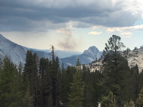
“The mountains are calling and I must go”, John Muir wrote in a letter to his sister in 1873, and after being in the Sierra Nevada mountains for the last few weeks, I can understand how he felt.
Although some of the toughest hiking, the Sierra Nevadas are also some of the most scenic
By mid-June, Chris and his hiking bubble had completed 25% of the trail, ending the “desert” portion of the trail. Starting June 14, he hiked out of Kennedy Meadows South, and began traversing the southern Sierra mountains. This part of the trail included the longest stretch of the trail with no access to resupply points, and no cell coverage. I camped with him at Cottonwood Meadow Campground, up in the Alabama Hills just west of Death Valley and the little town of Lone Pine on 395, and brought him a giant Subway sandwich and enough dry foods for eight days of hiking. Which makes a really heavy pack! When he left the next morning, he began the trek to get to the top of Mount Whitney, the tallest mountain in the continental US.
Chris set off in late April to hike the Pacific Crest Trail, hopefully in its entirety (2,650 miles). Visiting some friends and family along the way, he was able to leave our car with our friend Touch in San Diego, and arrived at the start of the PCT on the night of May 3rd. Months before, he had applied for a PCT permit, and had a start date of May 4 at Campo, on the California/Mexico border.
Chris at the start of the PCT
The PCT starts off hot and sandy, with moderate hills and few water sources in low-rainfall years. Chris hiked his way past small towns such as Julian, Warner Springs, and Idyllwild, and up and then down mountains such as Mt. San Jacinto (10,883 feet). Taking a long weekend, I flew to San Diego, picked up our car, and drove to the point where the PCT meets I-10 near Palm Springs. Thanks to the Garmin InReach GPS/SOS Chris’s parents bought for the hike, we actually timed it really well, and Chris arrived at our rendezvous only 15 minutes after I did. Having just hiked 20 miles down a mountain ridge, in an extremely windy area (known for its wind farms), he was happy to take a “zero” and a “near-o” to spend some time together, resupply his food pack, and rest his feet. We also visited Joshua Tree National Park (although, he was not interested in hiking any trails there… I wonder why).
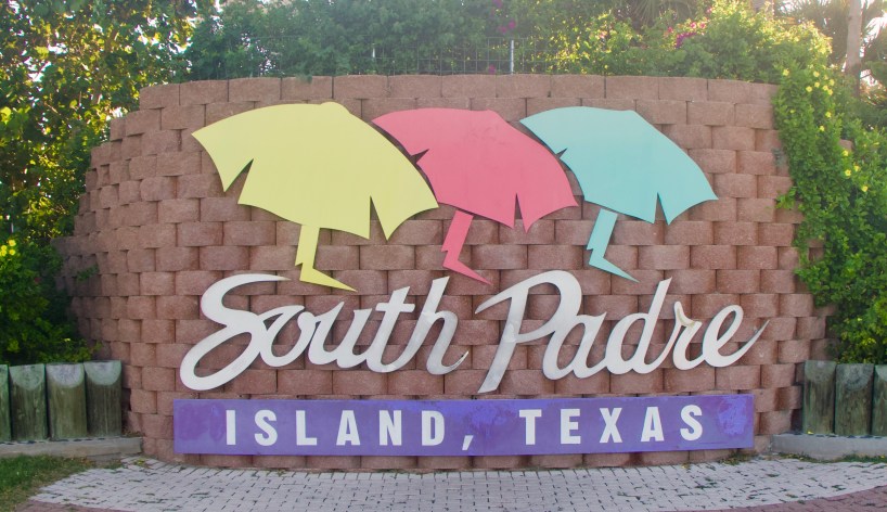
We had a four day weekend off of work this month, so Chris and I decided to spend a little time at the beach. We packed up our car and drove down to South Padre Island down in the Rio Grande Valley of south Texas. Now, the last time I was in SPI was 1997 and it was college spring break week- and I was there to see Vanilla Ice in concert. So I was interested to see how the island had changed over the last 20+ years.
South Padre Island, Texas
There is exactly one way to get onto South Padre Island, and that is via the Queen Isabella Causeway, from Port Isabel. You cannot enter the island from a more northern point, so just know that if you want to visit, you will need to go alllllllll the way down to the bottom of Texas to get there. From Austin, it took us about six hours. We arrived in time to grab an early dinner at Dirty Al’s, a Cajun-style seafood joint directly on the water. You can eat indoors or outside, and enjoy the Gulf breeze while watching the sailboats come in and out of the harbor. You can also book an island tour, sportfishing boat, or dolphin-spotting cruise from some of the businesses just steps away.
SPI Harbor
The entire south end of the island is Isla Blanca Park, run by Cameron County. To access those parts, you’ll need to pay a $12 day pass, or $5 for Veterans (you can also get a monthly or annual pass). Some of the cleanest beaches and best sunset-watching spots are down in Isla Blanca Park, as well as RV spots, cabanas, and a huge statue of “Cristo de los Pescadores”. But don’t worry. South Padre Island has plenty of free beaches in the mid-island and northern island sections.
Sunset at the Queen Isabella Causeway
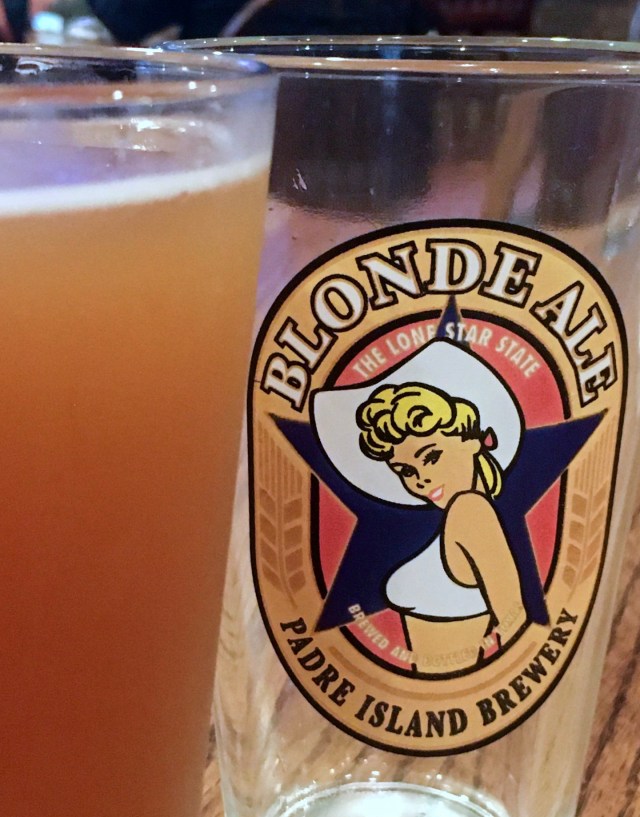
There’s always fresh, cold beer on tap at the Padre Island Brewing Company
For eating, drinking, and partying, most people head mid-island to Clayton’s, Bar Louie, and The Lookout. These 3 open-air bars are always full, with food and drink specials, music, and plenty of sandy feet. At night there’s usually a DJ or a band playing at one or more of these venues. For a more mellow vibe, try a local brew at the PI Brewing Company.
But South Padre Island has plenty to do for nature lovers as well. You can visit Sea Turtle Inc, or the SPI Birding and Nature Center. A bit further north from town, there’s the Stables, the SPI Equestrian and Events Centre. You can ride horses and zipline at the South Padre Island adventure park, or visit the Kite Boarding Ranch. If all of these sound too adventurous to you, just go to the end of State Road 100, and visit the beautiful white sand dunes and less-visited beaches in the north of the island.
The surge was high this weekend due to Hurricane Delta!
While we were on SPI, a hurricane was affecting the tides throughout the Gulf of Mexico, so we took some time inland to explore a little as well. Just south of SPI you can visit the SpaceX launch site. Be warned: although only 6 or 7 miles south of SPI, it takes a while to get there- you’ll need to drive inland about 25 minutes, and then double back on another road to get to the space center (it’s just before Boca Chica State Park).
SpaceX Launch Site
And if you’re wondering- can you walk across the border to Mexico? The answer is yes. There are 3 international bridges located in Brownsville, Texas, linking to Matamoros, Mexico. We walked across the Gateway International Bridge with our passports and $1 in quarter for the toll. On the Mexican side, you can hop on a bus to pretty much anywhere in Mexico (prepare for some long rides), or just have a cerveza and some lunch, shop a little, and head on back. Just a block or two over the border is a large shop and restaurant called Garcia’s- they have great food and specials on Mexican products and liquors. They took our temperature before we entered and sanitized our hands. The line back into the US took a bit longer than the one heading south- prepare for a bit of a wait- but it only costs 25 cents. Not bad for an international trip!