
Chris set off in late April to hike the Pacific Crest Trail, hopefully in its entirety (2,650 miles). Visiting some friends and family along the way, he was able to leave our car with our friend Touch in San Diego, and arrived at the start of the PCT on the night of May 3rd. Months before, he had applied for a PCT permit, and had a start date of May 4 at Campo, on the California/Mexico border.

The PCT starts off hot and sandy, with moderate hills and few water sources in low-rainfall years. Chris hiked his way past small towns such as Julian, Warner Springs, and Idyllwild, and up and then down mountains such as Mt. San Jacinto (10,883 feet). Taking a long weekend, I flew to San Diego, picked up our car, and drove to the point where the PCT meets I-10 near Palm Springs. Thanks to the Garmin InReach GPS/SOS Chris’s parents bought for the hike, we actually timed it really well, and Chris arrived at our rendezvous only 15 minutes after I did. Having just hiked 20 miles down a mountain ridge, in an extremely windy area (known for its wind farms), he was happy to take a “zero” and a “near-o” to spend some time together, resupply his food pack, and rest his feet. We also visited Joshua Tree National Park (although, he was not interested in hiking any trails there… I wonder why).


With new shoes two sizes larger than his old ones, I dropped Chris back on the trail at the I-10 underpass, and flew back to our home in Texas. He continued on, through the San Bernardino area, skirting Big Bear Lake, Wrightwood, and Agua Dulce, averaging about 20 miles a day. A heat wave came over the area, making hiking during the daytime nearly impossible (highs above 100 degrees), so he and a buddy hiker started hiking at 7 pm and through the night, resting in the shade during the day.

As Chris (whose trail name is “Long Haul”, as in “He’s in it for the long haul”) made friends and hiking partners along the way, I finished work for the school year and then flew back to California. I retrieved our car from LAX airport, and drove to Tehachapi, where I picked up Chris and his hiking partner “Gutfish” at midnight on a beautiful, starry night, with the temps (only) in the 80s. We all took a day off in Mojave/Tehachapi to resupply and to enjoy a warm meal, a cool shower, and a soft bed.
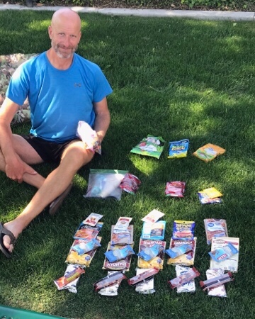
I dropped Chris, Gutfish, and another hiker friend, “Piñata” off at Tehachapi Pass to continue their northward journey. I hurried off to visit our friends Tricia and Kirk, whom we had met years earlier on our cruise to Australia. It was lovely to see them, visit Santa Maria, and hear about something besides trail miles and the best way to poop in the desert (sometimes hiker talk gets pretty pedantic). Three days later, I picked our hikers up at Walker Pass (elevation 5,250 feet), and we all took a day to rest at Lake Isabella, along with Gutfish’s other half Jamie, who is also following along as a “Trail Angel” to her hiker. We had a lovely dinner together, which was a welcome change from cold-soak ramen and peanut butter and tortillas (Chris decided to go ultralight and “no-cook” on this part of the trail).


From Tehachapi Pass, the hikers traveled up towards Kennedy Meadows (elevation 6, 214 feet). Taking a very scary and winding mountain road, both Jamie and I drove up Kennedy Meadows campground, where we hung out and waited for our hikers to arrive. Although not much of a “meadow”, Kennedy Meadows is a great stopping point for hikers, as it signifies the end of the Mojave desert, the start of the Sierras, and the last resupply point before really getting into the mountains. From this point on, the hikers will have to carry a bear-proof canister with them for approximately 300 miles. They have now completed 700 miles, or about 25% of the trail. Besides the campground, Kennedy Meadows features two small outfitters, and two hiker retreats featuring giant meals, free showers, laundry, and nightly bbq and karaoke. It’s a good place for hikers with minor injuries to take a bit of a rest, wait for Fedex packages from loved ones, and greet their trail friends as they emerge from the 40 or so days hiking in the desert. Once they are hydrated, rested, and re-geared, they will tackle the Sierra Nevadas, including the highest point on the PCT, Forester Pass (13,153 feet).


Interested in hearing about the rest of the PCT journey? Be sure to click “follow” below!

Hello!
Was just thinking about you guys and wondering what was next on your journey! Shoes 2 sizes larger!!
Skied Big Bear way back in the late 80s. And I remember the hot Santa Ana winds. Like an open oven door! Looking forward to the updates across the Sierras. xoxo
LikeLike
That’s so funny- I was just looking at our last texts and thinking “I need to check in and see how it’s going up there”. The Sierras are beautiful- hoping this heat wave doesn’t go up into the higher elevations.
LikeLike
Very inspiring. Maybe I can do hiking too if I could have someone else help me pack stuff, have someone carry a fan for me, and not have to walk so much. Is it still considered hiking if you have someone else carry you?
LikeLike
I mean technically you can hire a Sherpa for some hikes but I think they just carry your stuff, not you. 🤣
LikeLike
Deah, Thanks for continuing to inspire and encourage us! Kirk is hiking with Chris vicariously…lol. It was great to have you here for a visit and we are hoping the timing works out to meet up in Tuolumne on the 1st. Wishing Chris luck with weather and water on his stretch through the JMT.
LikeLike
Between your excellent updates and Christopher’s Garmin mileage news he seems to be enjoying himself. Are you sure he is hiking and not running? He’s covering a lot of territory so quickly..
LikeLike