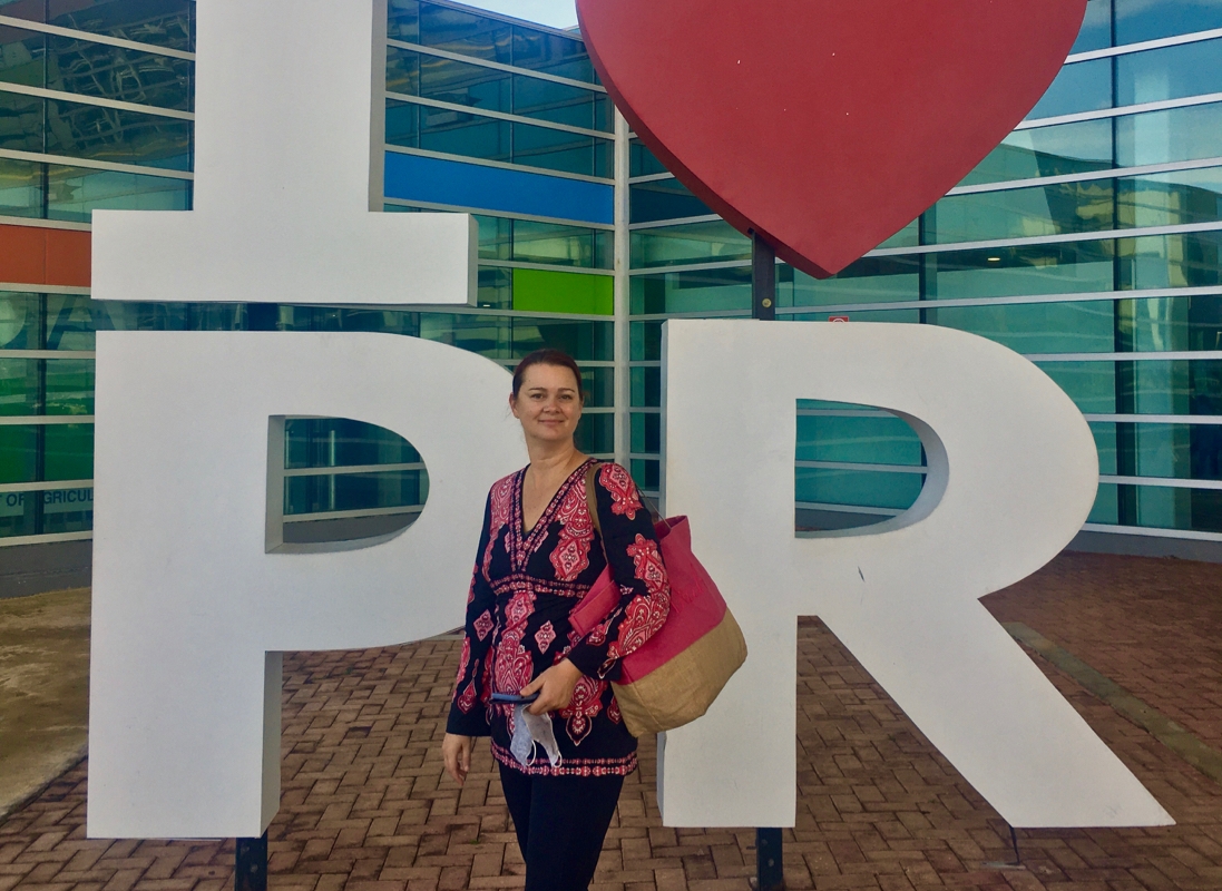
With ever-changing airline restrictions and countries closing their borders due to Covid, we decided to play it safe and travel mostly domestically for the time being. For our winter holiday, we chose to fly to Puerto Rico, which, being technically part of the United States, meant that we wouldn’t have to worry about finding and taking a Covid test to arrive or to return back to the US.
Old San Juan
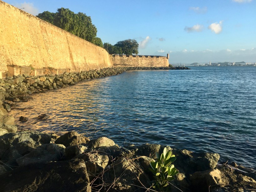
We spent the first few days in Old San Juan, enjoying colonial-style architecture, rich history, and delicious food. Between a walking tour of the small old-town area, and the two remaining fortresses, we learned a lot about the explorers, pirates, traders, and soldiers who have made San Juan their home over the past five centuries.
A view of El Morro, the San Juan defensive fortress, from the waterlineOld San Juan, the colonial cemetery, and new(er) San Juan in the backgroundThe flags of Puerto Rico, the United States, and the Cross of Bergundy (flown over forts built by Spain)
Favorite dish in old San Juan: the Puerto Rican Sampler at Deaverdura
Where we stayed: Hotel Casablanca (which features 4 stone bath tubs on the roof terrace)
Fajardo
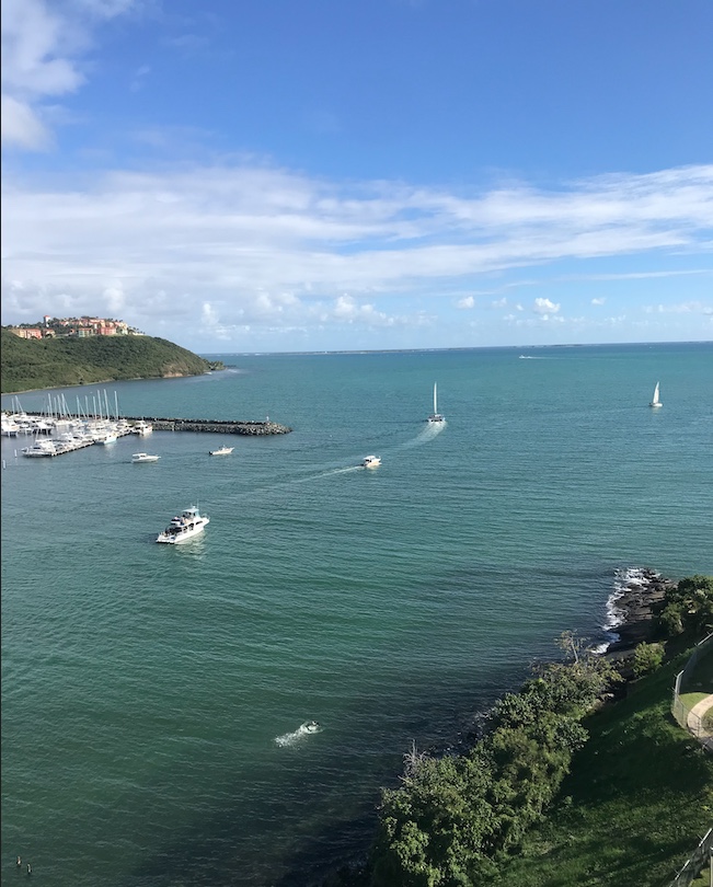
From Old San Juan, we took an Uber to the outskirts of Fajardo, a smallish town on the east coast of the island. We stayed at a high rise condo just beside a marina, and attempted to do something we rarely do: nothing. Our condo was a mile away from the nearest restaurant or small market, and two miles from the nearest grocery store. We loaded up on some provisions, had a delicious mofongo dinner out the first night, and then hunkered down for a few days. We did wind up booking a scuba diving excursion for Christmas Day, but other than that, we stayed put and watched the sea birds, the boats, and the water from our 9th-floor balcony.
Watching the boats in our harborA Merry Scuba Christmas!
Favorite dish in Fajardo: Mofongo relleno de Camarones en Crema de Cilantro at Sal y Pimienta
Where we stayed: A studio condo listed on AirBnb in the Dos Marinas Tower
Luquillo
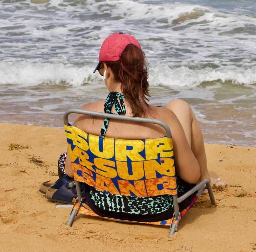
Luquillo is a laid-back beach town in the north of Puerto Rico, a perfect place for swimming, surfing, and drinking rum. We took a taxi from Fajardo to Luquillo, and arrived at our AirBnB apartment just a half block from Playa Azul. On our first evening in town, we walked over to the famed Luquillo Kioskos, a row of 30 or so bars and restaurants stretched out along the curve of a shallow bay. We drank beer and ate fried seafood and enjoyed the warm evening. For the rest of our time in the town, we tried out each of the other restaurants and cafes- Luquillo has just enough to try out two a day and not have to repeat, all without having to walk more than a mile. With views of the El Yunque Rainforest behind us, and the ocean in front of us, we were content to stay there and rest, relax, and toast the end of 2021.
Chris at the beach in LuquilloDeah reading at the beach An afternoon rain shower over the rain forest
Favorite food in Luquillo: Drinking a cold, creamy coquito. Here’s the recipe. I’ve already made two batches since we’ve been home.
Where we stayed: possibly my favorite Airbnb apartment. This one’s a gem, and under $100 a night
Of course this is only one small corner of Puerto Rico- there’s still so much to explore on this beautiful island (and the smaller barely-populated islands near it). Have you been to Puerto Rico? What was your favorite city or area?
After 18 months of staying in the US, Chris and I decided to dip our toes into the international travel scene again for my fall break. We chose Mexico for several reasons: direct flights, cheap prices, and easy entry requirements. As of November 2021, Americans do not need a Covid test to enter Mexico- just one to re-enter the US. We booked our tickets on Volaris airline, a Mexican carrier, and we were ready to go.
Plaza Constitution: the heart of Mexico City
Leaving your car at the airport for more than a few days can be expensive, so I looked up some cheaper parking options. We went with parkingaccess.com, which wound up being $35 to park our car at a nearby hotel for the duration of our trip. Be sure to read the fine print when choosing where to leave your car- try to pick a hotel with a free airport shuttle option (otherwise you’ll up your costs by having to take an Uber the last mile), and some local options provide covered parking, while others don’t.
While Chris hiked, I got to know several of the hikers who crossed his path on the trail or in towns. I gave rides to and from the trail, had lunch and dinner with hikers, and sometimes camped with them or shared hotel rooms when they were ready for a break from the daily grind of hiking. I tried to interview a few of them to find out why they had carved out 5-6 months of their life in order to come live in nature and hike 2,660 miles.
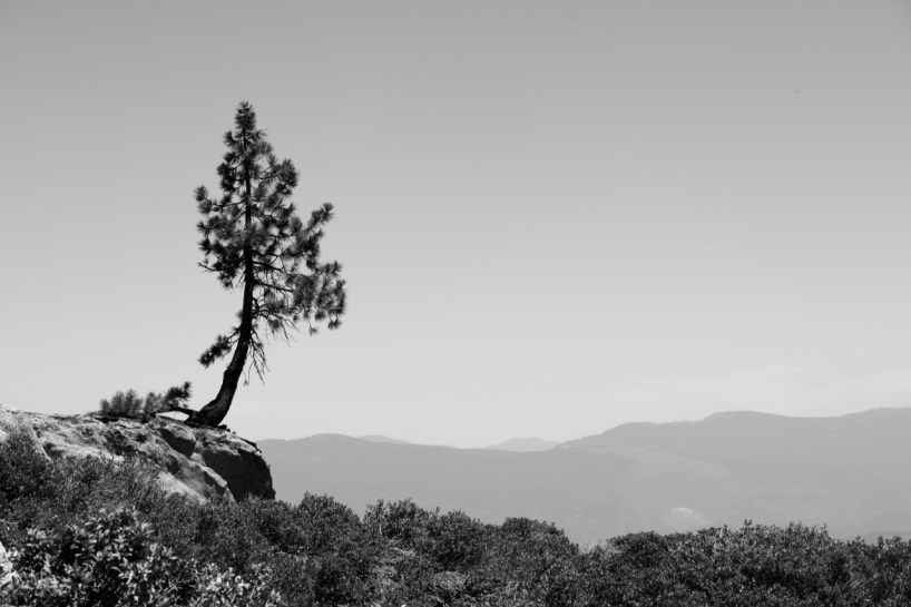
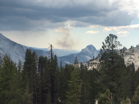
Californians and Pacific North-Westerners like to say they have five seasons: fall, winter, spring, summer, and fire season. By the time Chris reached the midway point for the Pacific Crest Trail, we were definitely into fire season.
This smokey vista portends our next few weeks
Although Chris was able to hike from Buck’s Lake to Belden Town, by the time he got there, the trail was closed heading north from Belden. I picked him and seven other stranded hikers up, and got us all to Chester. By the next day, the trail was closed from Buck’s Lake through to Chester, so he essentially was in the last group that got to hike that section. Although Chester was quite smokey, with some ash in the air, there was not an active fire close by (yet), so he was able to hike out of there. Luckily for us, our friend Piñata had booked quite literally one of the last motel rooms in the town, and we were able to stay with her for a night and catch up, as we hadn’t seen her since Mammoth Lakes.
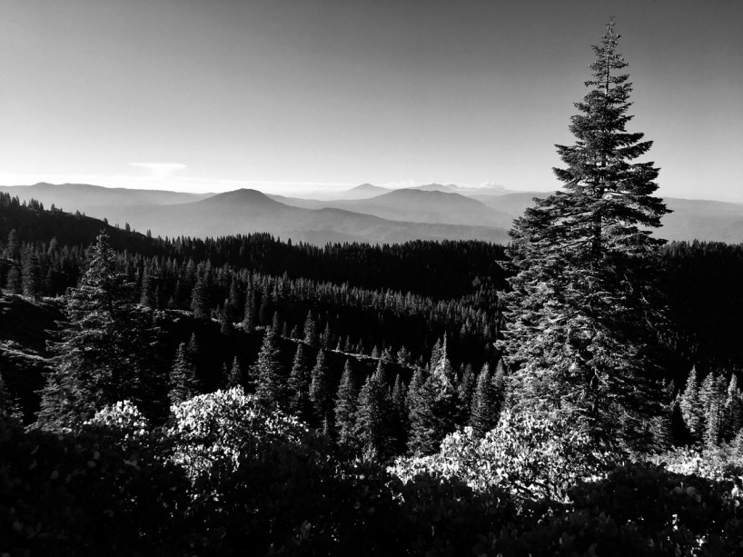
From Chester, Chris hiked north through Lassen Volcanic Park, and then to Old Station and the Hat Creek area. I drove to Old Station and we stayed at a campground there, and explored some cool lava tubes and a lava cave. And by cool I mean cold! It was fun to explore the pitch dark and chilly underground area.
Heading into Lassen Volcanic National Park
I drove to Burney Falls, giving some hikers rides along the way. Back in Chester, it was getting even more smokey, and the fire was advancing, so lots of hikers skipped past it and needed rides to get further north to get back on the trail. Soon both Belden Town and Chester were evacuated, and later, a town in between them, Greenville, actually burned to the ground. The devastation was unimaginable. Both the Tamarack Fire and the Dixie Fire forced more and more hikers to get off trail and skip dozens, then hundreds of miles of trail, ranging from Tahoe almost up to the Oregon border.
Burney Falls- definitely worth the extra time to hike down and see it from the bottom
We took a rest break in Burney, and went swimming in the lake, and enjoyed a picnic. I camped for a night actually on the trail with Chris and a bunch of the other hikers (they laughingly called my 4 person tent a “palace”). Then I hustled up towards the Mt Shasta area/Castle Crags/Dunsmuir area, and tried to get a room. With so many hikers forced to jump north on the trail, it was getting harder and harder to book motel rooms and to find fully stocked grocery stores for resupply. And that’s how we ended up staying in a “haunted hotel” in Dunsmuir– featured in the show “Ghost Finders” and in “Ripleys Believe it or Not”. Actually we spent a very pleasant night in Dunsmuir, and enjoyed a short hike to a view point at Castle Crags State Park.
Often called the “Upside Down Hotel”, the Hotel Dunsmuir originally had their lobby at the bottom level, across from the Amtrak station. Now the lobby is at the third floor, street level.
While Chris advanced north from Dunsmuir, I stayed in town a couple of more days and hung out with Sunny, Sandman, Piñata, and some other hikers. The town of Mt Shasta had an outdoor concert at a park near the headwaters of the Sacramento River, and most of the hikers who were in town showed up to enjoy the show. With so many hikers in town, we could only get a hotel for one night, so Piñata and I camped a second night on the lower reaches of Mt Shasta, enjoying a fantastic sunset as we set up our tents.
Smokey clouds make for a great sunset!
Although so, so close to the Oregon border at Mt Shasta, the PTC actually take a turn to the west, then north, then back east again. So we still had 200+ trail miles to go before we reached Oregon. I drove west to the small town of Etna- and fell in love. The town is small but has everything I needed- a brewery, a distillery, another brewery, and a small library- and they are hiring a manager for their library! I was almost ready to send in my application, but the job was only for ten hours a week. I’m sure I could maybe raise chickens, or learn about brewing beer, in my free time?
It’s tempting to get stuck in trail towns, but the key is to keep on walking. Even when you don’t want to.
The town of Etna was kind enough to allow hikers (and hiker-adjacent people like me) to camp in the City Park for $5 a night, so I wound up getting stuck in a hiker vortex there for three days. The trail crosses the road 13 miles from town, and it’s not an easy hitch, so every time I took a car load of hikers out to the trail, there would be another group waiting to go into town, and they would offer me lunch or dinner or drinks, and then the cycle would start all over again. I even met a gal whose parents own a business on our street! What a small world.
These hikers are ready to get back on the trail!
But I did pull myself out of it eventually, mainly because I wanted to go visit the Redwood Forest while Chris hiked the last hundred miles through Seiad Valley, the last “town” in California along the PCT. I spent three days driving around and hiking around the Redwoods, until I had a crick in my neck from such much looking up at the giant trees. And I know I’ve probably said this before, but this time I really mean it: I think this national forest is the best of them all. Coupled with the fantastic foggy northern Cali coast, it can’t be beat. I loved it.
Some pretty big trees in the Redwood Forest! The California coast
I hung out in the Oregon Caves National Monument on my way back to the trail, and then suddenly we were in Ashland, the first trail town in Oregon! Although sometimes it seemed like California, which makes up 60% of the Pacific Crest Trail, would never end, it did. While we were in Ashland, buying (hopefully) one final pair of shoes and repairing Chris’s tent, hiker friends back in Etna and Seiad were leaving the trail and hopping north- the trail had been closed out of Etna due to smoke and a nearby fire. Unfortunately, Ashland and on up to Crater Lake weren’t much better- some hikers began making plans to hike an “alternate route” along the coast.
Chris reaches the Oregon border
It was the end of summer break for me, so I took the car to Portland, hung out with friends there for a day, and attended a travel social event with our friends at Wild Spirit Travel. After stuffing ourselves with food from Portland’s food trucks, it was time for me to jump on a plane and head back to Texas and mentally prepare for work. Four days after I left, Chris had completed another 120 miles to Crater Lake- and is now done with 3/4 of the trail. Just 825 miles to go!
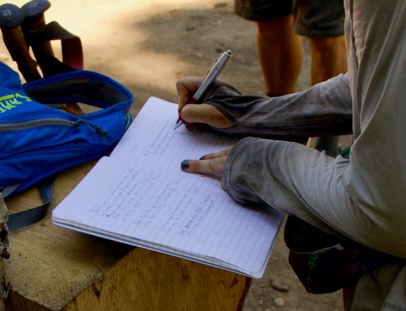
A hiker signs in at a trail register along the PCT
Interested in some interviews I did with other hikers? If so, click the “Follow” button and get my next post.
“The mountains are calling and I must go”, John Muir wrote in a letter to his sister in 1873, and after being in the Sierra Nevada mountains for the last few weeks, I can understand how he felt.
Although some of the toughest hiking, the Sierra Nevadas are also some of the most scenic
By mid-June, Chris and his hiking bubble had completed 25% of the trail, ending the “desert” portion of the trail. Starting June 14, he hiked out of Kennedy Meadows South, and began traversing the southern Sierra mountains. This part of the trail included the longest stretch of the trail with no access to resupply points, and no cell coverage. I camped with him at Cottonwood Meadow Campground, up in the Alabama Hills just west of Death Valley and the little town of Lone Pine on 395, and brought him a giant Subway sandwich and enough dry foods for eight days of hiking. Which makes a really heavy pack! When he left the next morning, he began the trek to get to the top of Mount Whitney, the tallest mountain in the continental US.