Don’t Yuck out on the Yucatan

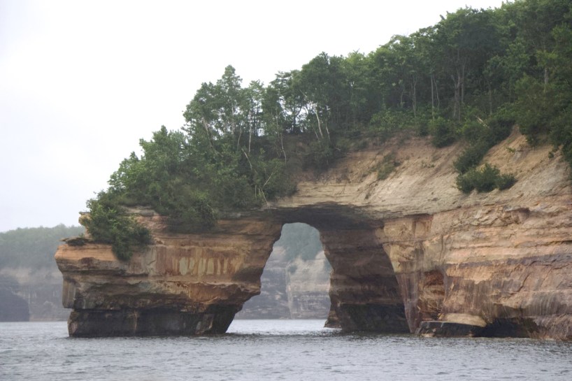
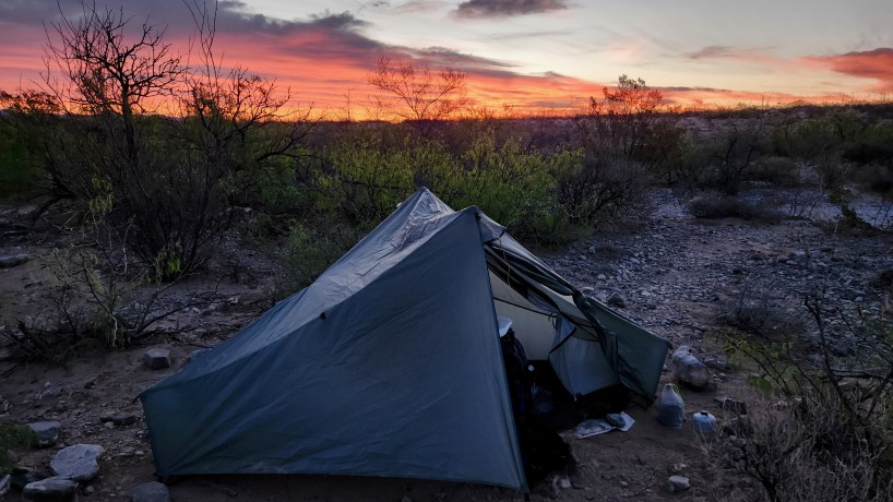
If you’re looking for a solid week of adventure, fun, and food, look no further than the Yucatan Peninsula in Mexico. For ritzy beach and all-inclusive resorts lovers, look to the north end at Holbox, Cancun, Cozumel, and Playa del Carmen. If ‘pueblo magicos’ and dusty beach towns is more your style, consider the southern end, Tulum and Valledolid.

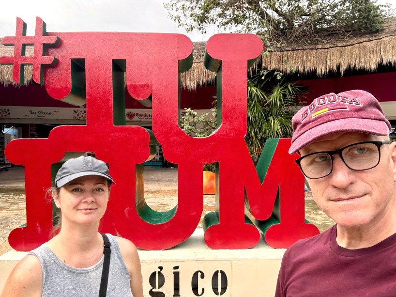
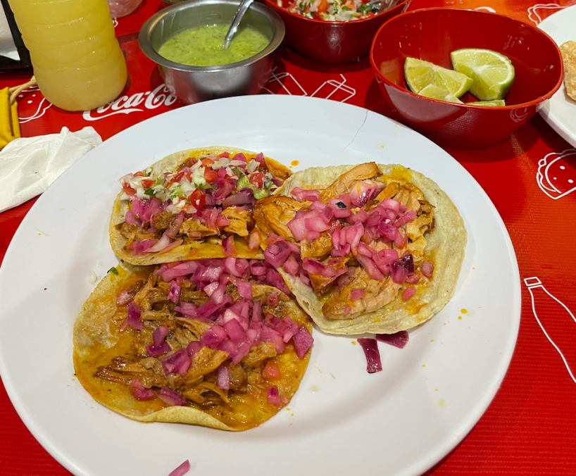
We wanted to visit some Mayan ruins and also dive at some cenotes, so we decided on exploring the quieter side of the Yucatan. We flew into the fairly new Tulum international airport, and hopped on the ADO shuttle bus into town. Our hotel was just two blocks from the bus station, so it was an easy walk to BAU Tulum, a cute boutique hotel. And then the search for tacos and cervezas was on!

Spoiler alert: it didn’t take long to find!

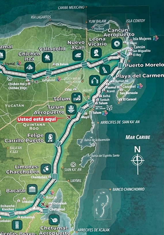
Tulum has a nearby international airport, as well as direct bus and train lines to nearby cities and tourist destinations. It has rounded the corner from “sleepy beach town” and is now considered pretty “boho chic” and might be on it’s way to “pricey resort town”. You can still get an inexpensive hotel and dinner out for under 500 Mexican pesos, but you can also visit one of the 8 Michelin-rated restaurants in town and stay at an upscale resort or condo. Tulum has a bit of a focus on health and wellness, so it still attracts a lot of backpackers, local tourists, and off-the-beaten path adventurists. It’s super easy to hop into a collectivo and visit sites north or south of town, or head to the ADO bus station to get a direct bus to Playa del Carmen, Valladolid, or Merida. There is also the Mayan Tren option if you want to take it direct north to Cancun or south to Chetumal.

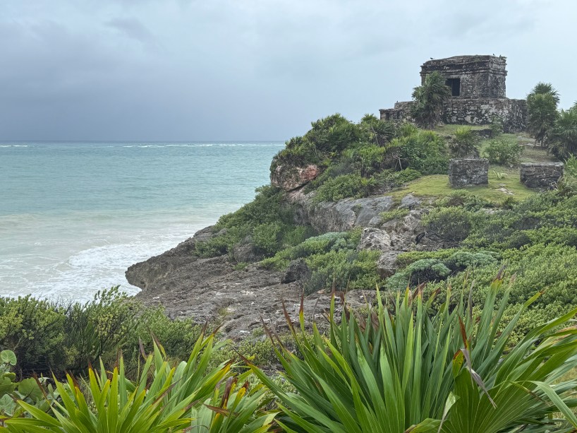
Just north of Tulum is the Tulum Ruins, a Mayan archeological site dating back to the 13th to 15th centuries, called the “City of the Dawn” due to it’s east-facing orientation at the edge of the peninsula. It is considered rare for the Mayans, because it is a walled city. It likely had a population of 1,000 to 2,000 people. It’s fairly easy to visit from the town of Tulum- you can actually walk or bike there from town, or just flag down a collectivo heading north and ask to be let out at the Tulum ruins, which should cost you about 30 pesos per person. Visiting the ruins, unfortunately, is not so inexpensive, and will run you closer to 400 pesos, as it is now part of Mexico’s official INAH (National Institute of Archeology and History). The entry ticket will get you into the museum, the ruins, the lighthouse, Jaguar Park, and a visit to the nearby beach. The ruins are open from 8 am to 5 pm daily.

The Tulum ruins are perched on a cliff overlooking the ocean

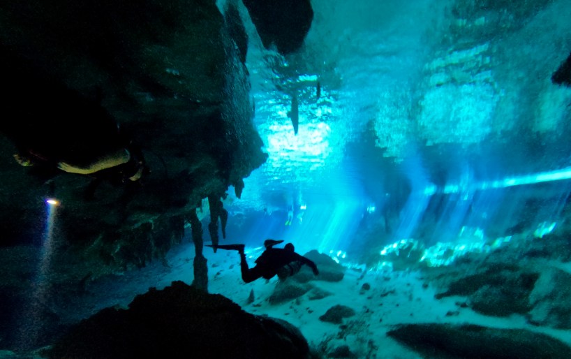
Another fun thing to do while in the area is to visit a cenote and take a swim. These natural sinkholes were formed ages ago by rainwater filtering through limestone caves, some with collapsed ceilings, letting in sunlight and rainwater. Civilizations as far back as the Mayans knew about these freshwater sources, and were considered sacred sites (many cenotes have had human bones excavated from their depths). The Yucatan has more cenotes than any other place in the world. One of the most famous, and most dived, cenotes is Dos Ojos. We contacted a local dive shop, Agua Clara, and they took us on a two-tank dive to this beautiful site. We did two 45-minute dives, swimming from one cenote, through a cave, and then into the other cenote, and then back again. The water was chilly but not freezing (I wore a shorty wetsuit, while Chris dove in just his swim trunks), and the fresh, cold water was stunningly clear. Swimming amongst the stalactites and stalagmites was something I will definitely never forget. What a wonder!

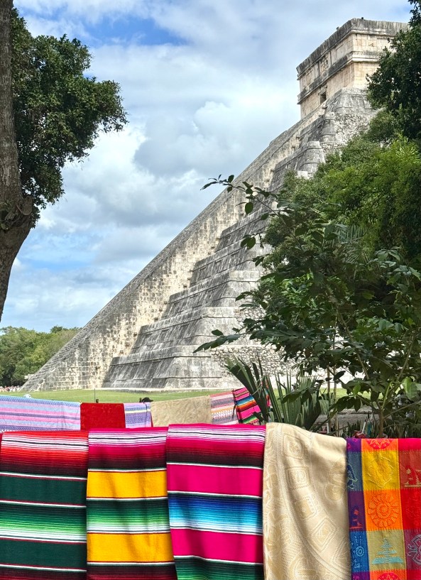
We liked roaming around Tulum a lot, but we wanted to check out Valladolid as well, another of Mexico’s “pueblos magicos”. Buses run daily between Tulum and Valladolid, so it was no problem hopping on one and arriving in the town two hours later. We settled in at Valladolid 48, a hotel/hostel just off the main shopping/dining area, and had a wander through town. The next day, we walked to the collectivo station and for 100 pesos, got a round-trip ticket to Chichen Itza and back (or you can get one that includes a visit to a nearby cenote on the return). The Chichen Itza ruins get pretty busy (and hot in the afternoons), so it’s advisable to go as early as you can. You’ll have to brave long rows of vendors selling everything from jewelry to statues, blankets to macrame, on your way in and out of the archeological site. This one will cost you around 600 pesos each, made in two different payments (one to the federal government of Mexico and one to the local Yucatan government). Once inside, you’ll run the gauntlet of even more vendors, but finally you get to the wide, open area and take a look at “El Castillo”, with 365 steps leading to the top of this four-sided pyramid. All of the monuments at Chichen Itza are roped off, no climbing, no touching, which is probably for the best. If they weren’t roped off, there would probably be a Coca-Cola refreshment stand at the top of one, with a guy selling soapstone pyramid statues next to it.

While in Valladolid, we visited an apiary in an old dried cenote and learned about different kinds of bees, we watched a sound and light show at the old convent church that told the history of the area, and we tried all kinds of different foods and drinks. One of our favorites was actually an Argentinian restaurant that makes their own kombucha and empañadas, called Tresvanbien. I wish we’d had time to visit there again, but the next day we wanted to try another new place, and didn’t regret the dinner at Papillon Taqueria, or drinks at The Mule Cantina in the Calzada de Los Frailles street. It’s close to the bus station and has plenty of options for casual or fine dining, and is a particular gem in the evenings.

If you get tired of tacos, there’s always empañadas

Have you visited the Yucatan? Do you prefer the beach, golf, and all-inclusive resorts in the north, or the ruins and the cenotes further south? Got a favorite taco stand you’d like to share? Tell us all about it.

Taxco, the silver capital of Mexico

Taxco Mexico main church

November is such a nice time of year to visit Mexico- beautiful weather, low crowds- so this year we decided to spend Thanksgiving break in Taxco, one of Mexico’s “Pueblo Magicos”, or Magic Towns. These charming small cities feature walkable city centers, historic churches and plazas, and plenty of delicious options to eat and drink.

Arriving at the Mexico City airport, there’s three easy ways to get to downtown, or to any of the main bus stations. You can hop in a taxi, take the Metrobus, or walk all the way down to Door One and access the subway. For 15 pesos (75¢ US) you can buy a metro card, and then each ride is 5 pesos (25¢). Two people can share one metro card. We transferred to the blue line’s last stop, the Tasqueño bus terminal. It’s a very nice, very modern bus terminal, and we found busses departing for Tasco every 90 minutes. 554 pesos later (approx $25 USD), we had two bus tickets on Costa Lines and were on our way.

We arrived in Taxco two and a half hours later and walked from the central bus station to our hotel, the Posada de San Javier ($65 per night for a king suite, with breakfast). The city of Taxco trails down the side of a mountain, so it doesn’t matter where you stay- everywhere you go is going to be a short but steep climb from your hotel or restaurant or the main zocalo. Just take it slow and steady, or hop in one of the ubiquitous VW taxis that constantly circle the plazas.

The stunning main feature of Taxco is the twin-spired baroque Church of Santa Pisca, built from 1751-1759. Everything else in the historic city can be found in relation to the church. Wanting to really relax on our trip, we spent four days in town and found ourselves lounging on rooftop terraces, enjoying coffees and chilaquiles in the mornings or hot chocolates and churros in the evenings. We spotted a few other gringo tourists in town, but the majority seemed to be visitors from other parts of Mexico or Latin America. Taxco feels safe, is easy to walk around, and has options to fit any budget.

The main plaza, or zocalo

Our favorite activities in Taxco:

  1. Take the cable car up to the Hotel Montetaxco and enjoy the view from their mirador, while sipping a juice cocktail. It costs 9 pesos to hop in a collectivo (combi) to reach the base of the teleferico. Round trip tickets on the cable car are 120 pesos, or you can take the cable car up and walk down.
  2. Visit the Pre-Historic Mine, located underneath the Hotel Posada de la Mision. Tickets are 180 pesos and come with a mezcal cocktail afterwards at the hotel bar. The tour is in Spanish but the guide translates parts of it.
  3. Visit the silversmith shops or workshops, pretty much all over the city. Look for the .925 or .950 stamp if you’re looking to buy, or just enjoy watching the sheer talent of the artisan workers.
  4. Eat pozole at any number of pozolerias (Tia Calle was very inexpensive, if not very atmospheric).
  5. Try the region’s pink rosa mole dish, made with rose petals and white chocolate. We enjoyed the dish at La Parroquia, which features balconies and a terrace overlooking the main zocalo. A perfect al fresco dinner spot.
  6. Plenty of places offer chocolate and churros, but we liked Chu Cho, nestled in Plazuela de Bernal, for their wide variety of toppings (try the marzipan!).
  7. Visit the Pozas Azules (blue swimming holes). You can take a full-day guided tour from one of the tour operators in town, or just walk to the main road and grab a combi heading out of town toward Acapulco (the stop is in front of the Coppell building). The combi costs 35 pesos, and entrance to the pools is 100 pesos.
  8. Tour the Spratling Pre-Hispaña Museum. Spratling put Taxco on the map in 1929 and made sure its pre-Hispanic culture would be preserved. This museum features his private collection of artifacts. Worth a visit, and only 75 pesos per person.
  9. For another beautiful view of the town, visit the Cristo Rey statue above the main plaza. It takes about 45 minutes to walk up there, or take a taxi for 80 pesos.
  10. Eat as much ice cream as possible. We liked the Crema y Nata Heladeria, tucked into the bend right at Plaza Del Convento. Delicious!

Have you been to Taxco, or another of the Pueblos Magicos in Mexico? What was your favorite part?

Albuquerque Balloon Fiesta 

After wanting to go for several years, we finally made the time to go to Albuquerque, New Mexico for their annual balloon fiesta. And wow, am I glad we did!

The balloon fiesta is now in its 52nd year, with over 700 balloon pilots and their teams working hard every day for two weeks to launch their balloons every morning, and provide other fun activities in the evenings, such as a “glow”, a drone show, concerts, indigenous dancing, and skydiving.

We stayed with friends of ours who live in the area, and one of them is a “zebra”, or Launch Director, for the fiesta. They are called zebras because they wear black and white only, so they can be seen on the fields as they direct the launch of multiple balloons near them during the daily Mass Ascension.

A zebra in action, helping to launch a balloon

Because balloons most frequently launch at sunrise, we had to get up very early in order to get to the festival and be in place in time for sunrise. By 5 AM, thousands of visitors were arriving at the balloon fiesta complex, getting ready for the 7 AM sunrise. We had backstage passes from our friend, so we were able to access the breakfast provided to the pilot and their teams, as well as warm up a bit in the facilities. It’s very cold in the morning before the sun comes up. Be sure to dress in layers, and even bring a blanket to wrap up in. The city of Albuquerque is at quite a high elevation, in the mornings and evenings can get very cool.

I would recommend purchasing tickets to both a morning event and an evening event, and possible a third morning or evening as back up. The tickets are fairly inexpensive at $15 for general admission, and kids 12 and under are free. Each year, one day of the festival is free for New Mexico residents. Visitors can pay for parking at the balloon complex, or can purchase Park and Ride tickets and board a bus at the nearby mall or churches.

A wave of balloons get “fanned” with cold hair, before using hot propane gas to “stand up” and then launch

Have you been to a huge balloon festival? If you haven’t, I definitely recommend the one in Albuquerque! Now in it’s 52nd year, it is a classic.

Beat the Heat with These Northern National Parks

Isle Royale National Park

Even though I’m from Texas, I try everything I can to get out of the insane southern heat each year. Last summer we visited Maine, Newfoundland, and Labrador. This year we decided to head to some of the US national parks up north in an attempt to find cooler temps.

Time to head north

As we crossed the Mackinac Bridge into Michigan’s Upper Peninsula, we felt the cool breeze coming off the Great Lakes, and knew we had arrived in “the north”. If you’ve never been to the UP, I highly suggest you take a few extra days and visit Pictured Rocks National Lakeshore, as well as the Great Lakes Shipwreck Museum. Those are two of my favorite tourist attractions up that way, and definitely worth a visit.

Pictured Rocks National Lakeshore- do yourself a favor and do the boat ride!

The first park on our list was Isle Royale National Park– the least visited park in the continental US. As it is an island, you can only access Isle Royale from upper Michigan (from Houghton, by boat, or Copper Harbor, by boat or sea plane), or from upper Minnesota (from Grand Marais by seaplane, or Grand Portage, by boat). Whichever mode of transport you choose, make sure to book well in advance (at least a month), and be forewarned that although it’s a national park, the transport is private, and quite costly. Of course, bring your national parks pass if you have one for free entry, and our camping on the island was free as well.

Established as a national park in 1931 by Herbert Hoover, this gem is only accessible by boat or seaplane

From Pictured Rocks, we drove to Grand Portage, Minnesota, and took a 7:30 am ferry (stay at the nearby Grand Portage Lodge and Casino for an easy morning). By 9:30, we were getting dropped off at the island’s Windigo visitor center, and walked to the nearby Cottonwood Campground with our camping gear. It’s only 1/4 of a mile away, so you won’t have to lug your stuff too far. There are potable water spigots at the campgrounds, so don’t worry about extra water for all your days in the park. We lucked out and were able to get a small camping shelter rather than a tent site, which was nice, because Isle Royale is often rainy (and putting up or taking down a tent in the rain is no fun).

Feldtmann Lake Overlook hike, about six miles, definitely worth it

In our time on the island, we hiked, explored the Visitor Center, checked out the small store (they do have food there, including hot breakfast sandwiches, so you can supplement the camping food you need to bring), hiked some more, and looked for wildlife. Isle Royale has both moose and wolves, so visitors like to keep a sharp eye out. The Windigo side of the island only gets about 50 visitors a day, so it won’t take long to get to know your fellow campers and hikers and find out where they’ve spotted some wildlife.

We spotted four moose while we were on Isle Royale. They can be unpredictable, so keep your distance, and keep a tree between you and them (we have a good telephoto lens)

In addition to Windigo, you can visit the other end of the island, Rock Harbor. You can take a boat there (from Windigo or from the mainland), or you can do a multi-day hike of the 45 mile stretch. Rock Harbor also features a nice lodge and restaurant.

Boardwalks, bridges, and hiking trails connect various campgrounds on the island

Even in July, the temperatures on Isle Royale ranged from pleasantly sunny and warm low 70s, down to cool and rainy 45 at night. Bring lots of layers, bug spray, and waterproof bags. We had a spectacular sunny day, cool night, and rainy morning while we were there.

After ferrying back to Minnesota, we were only a few miles from the Canadian border. Just after crossing over we saw a wolf! Canada has the best wildlife!

Voyageurs National Park is only 4-5 hours west of Isle Royale, so we drove the Canadian route to get there, stopping at Thunder Bay and Kakabeka Falls along the way. I always love taking Canadian roads because of their beautiful scenery, and lack of advertising billboards. We spent a lovely evening at the Bay View Motel in Fort Frances, next to the delicious Harbourage Restaurant. At International Falls, we crossed back over to the US, and visited the Rainy Lake Visitor Center and then the Ash River Visitor Center.

Our 51st National Park together!

Spread across 210,000 acres, the star feature of Voyageurs National Park is the lakes, rivers, and inlets, so I’d highly recommend booking a NPS boat tour in advance, renting a kayak or canoe, or even staying on a houseboat nearby. There are also plenty of hiking trails and wildlife to view from land or from water, including beaver, otter, moose, and bears.

We actually saw this handsome fella about an hour after we left the park

Similar to Isle Royale, this northern national park features excellent weather in the summer. Temps while we were there ranged between 77 and sunny, down to about 60 during a rainstorm. Voyageurs does tend to be very buggy, so long pants, bug spray, and even a net hat might be a good investment if you plan to spend a few days here.

Bring your rain jacket too!

After Voyageurs, we had one more northern park on our list that we had not done yet. We passed into North Dakota, and after stopping at the Geographical Center of North America, we arrived at Theodore Roosevelt National Park.

We are soooo centered

Theodore Roosevelt National Park is spread across three distinct “units” (north, south, and Elkhorn, linked by the Little Missouri River), and we visited two. This park is 70,000 acres, and was designated a National Park in 1978- the only one named after a person! Roosevelt built a cabin at Elkhorn and lived there for several years, studying ranching, hunting, and conservation, before he became president in 1901.

Similar to the Badlands of the Dakotas, the rock formations here are shaped by erosion

The park has a semi-arid climate and features pronghorn, mustangs, elk, bison, bighorn sheep, prairie dogs, coyotes, cougars, and more. We almost crested 80 degrees while we were there, but some late afternoon cloud coverage kept us in the upper 70’s. Since it was 101 back home with a hurricane bearing down on our state, we were happy with 79 degrees and a light rain shower!

Wild buffalo roam the prairie in the park
You can visit several prairie dog towns and watch these cute critters at play!

Formed by layers of ash from volcanoes 65 million years ago, layered with sediment brought by wind, water, and freezing, the hills of the badlands can present really interesting striped colors and formations. Lazy rivers that have formed oxbow lakes meander along the prairie as well, growing rings of cottonwood trees along their banks. Fossils from a long-ago swamp in this area have revealed large clams, crocodiles, alligators, turtles, and champsosaurs.

Oxbow overlook

Exploring our national parks is a fun pastime for us. We love getting out in nature, taking a hike, watching for wildlife. Learning about the history and geography of each area is fascinating too. Each park has its own unique setting to enjoy and partake in. Which national parks have you visited? What was your favorite? Leave us a comment.

Interested in this kind of content? Hit the subscribe button!

Hiking the Continental Divide Trail (New Mexico)

This past month, one half of the Palm Tree Musings duo started a section hike of the Continental Divide Trail. Having previously completed a through-hike of both the Appalachian Trail and the Pacific Crest Trail, Chris decided to try a section hike for this next adventure. Here’s the particulars of the first 400 miles, all of which are in the New Mexico section of the 3200 total miles of the trail, which spans five states.

Getting Started

Chris started his hike at the Mexico/New Mexico border near Hachita on April 23. To get there, he took a Greyhound Bus to Lordsburg, New Mexico, and then arranged for a hiker shuttle to the starting monument, as well as a couple of water caches in the desert. Over the next week, he and his hiking partner Piñata hiked across flat desert and arid mountains to get back to Lordsburg, where I met them for a day or two of rest and relaxation in Silver City.

Long Haul and Piñata, at the start of their hike
Chris’s new ultra-light tent
Some parts of the trail are paved, some are dirt roads, and some are barely-there paths through the mountains

The Trail Town of Silver City

Silver City is a fun trail town to visit and take a zero day (Lordsburg is not). The main street of town features a dozen or so restaurants and bars, as well as a grocery, a small museum, several vintage thrift shops, and other fun things to explore. There are several motels, Airbnbs, and hostels in town, and pretty much any day in April or May you’ll see other hikers in town resting up. Silver City Post Office and Urgent Care Clinic are easily accessible and had great customer service (we visited both). The three of us enjoyed our Airbnb, trivia night at the Little Toad Creek Brewery, and a visit to the nearby Gila Cliffs National Monument. It was a welcome rest from the trail, as well as our anniversary (the third we’ve spent on a long distance hike) and then the hikers were off again, heading north.

Meeting my hikers just outside of Lordsburg
An afternoon at the Gila Cliffs National Monument
Resupplying from the grocery store and loading up for the next stretch

Silver City to Grant’s Pass

Sufficiently rested up, Long Haul and Piñata continued their hike, which they were planning to end around Albuquerque. They hiked through the Gila National Forest, crossing the Gila River dozens of times. Near the Cliffs National Monument, they rested a day at Doc Campbell’s Post, a hiker-friendly respite near some hot springs. From there they continued north, sleeping on the trail and hiking 20-25 mile days. The weather was getting warmer, and they often started at 6 am, stopping in the afternoon under a tree for a siesta in the hottest part of the day, then continuing for some more miles in the evening. Chris and Piñata stopped for a night in Reserve, and were able to get a shower and a rest at The Frisco Lodging and RV Park. Refreshed, they got back on the trail, but were met with some rain and even some hail near Alegres Mountain. Happily, they found a hiker’s lean-to nearby, and were able to shelter out of the weather. They dried out at the Toaster Hostel in Pie Town (which does, in fact, have two places to get pie), and then pushed on for their last leg of this section. They arrived in Grant, New Mexico, on May 19, 27 days after they started their hike. From there, a quick bus ride to Albuquerque, and they were back to civilization, no longer hikers, and ready to start planning their next section hike. Stay tuned for more information on that!

Crossing the Gila River
Any shelter will help when a storm rolls in
Official end point to this section of their hike

Have you hiked the Continental Divide Trail? Drop your best trail hints below.